

The following article was written by Michael Fagin. Fagin is an operational meteorologist providing weather forecasts to clients in the Pacific Northwest and providing custom forecast for groups climbing Mt. Everest and other major peaks. Fagin is also a travel writer with a focus on weather and wine.
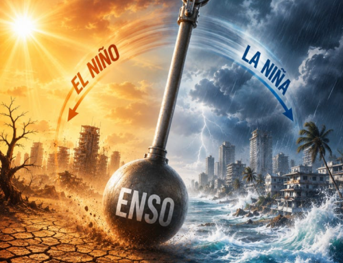
As we move further into spring, the El Niño conditions that have been in effect since last fall are fading. Now, we are looking at the return of La Niña. Here we recap some of the weather patterns that have occurred since our last report in January, update on snowpack and drought conditions, and discuss what impact La Niña might have on weather conditions this summer and beyond.
El Niño effects on winter snowpack
This past winter there was a strong El Niño. This is defined as having above-average sea surface temperature anomalies off the equatorial waters of South America.
When there is an El Niño, the greatest impact in the Pacific Northwest is on winters. Winters will usually have above average temperatures and below average precipitation. This combination will generally result in below-average snowpack.
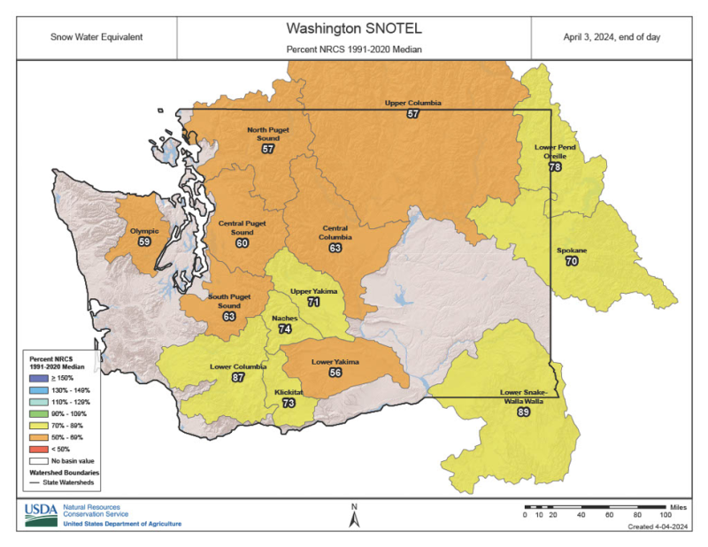
How did things end up in terms of snowpack? Winter snowpack is best measured in early April. The map below shows conditions on April 3, 2024. All of Washington’s major basins recorded below-average snowpack. In Eastern Washington, the Lower Yakima snowpack was at 56% of average while the Lower Snake/Walla Walla basin checked in at 89% of average. These numbers were up slightly from our January update.
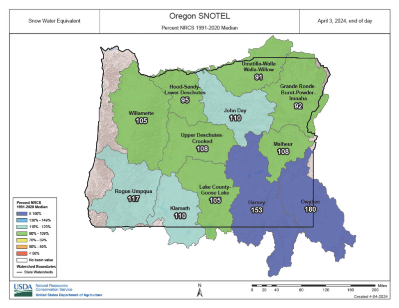
Oregon was a much different story. In January, much of Oregon was close to 50% of average. The map below shows the Willamette Basin snowpack was up to 105% of the average by April. What happened?
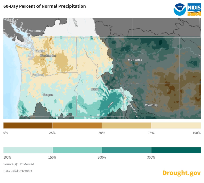
The map below shows precipitation as a percent of the average for the 60-day period preceding March 30th. Much of Oregon (green) recorded above-average precipitation during this period, while parts of the Columbia Basin (darker brown) was at 25 to 50% of average. This difference was a result of a storm track aimed toward Oregon and Northern California during this period.
In summary, many regions of Washington have below average snowpack. This was well-predicted by NOAA. Oregon ended up with an average to above-average snowpack. NOAA forecasted below average snowpack.
Temperature trends
Please login below to see full content or Subscribe Now to get immediate, full access to our ratings and reviews, review database, featured articles, and other subscriber-only content.
To receive articles via email, click here.


Leave A Comment