

The following article was written by Michael Fagin. Fagin is an operational meteorologist providing weather forecasts to clients in the Pacific Northwest and providing custom forecasts for groups climbing Mt. Everest and other major peaks. Fagin is also a travel writer with a focus on weather and wine. Read other articles by Fagin here.
In our most recent update, we discussed weather conditions in the Pacific Northwest from mid-October 2025 to early January 2026. Here, we examine recent temperature and precipitation trends in the Columbia Valley and the Willamette Valley from early January to the end of March. We also look at short-term weather forecasts and what the rest of spring might bring. Finally, we examine the current snowpack and whether it will be sufficient to meet water needs during the growing season.
Recent temperature trends
Washington
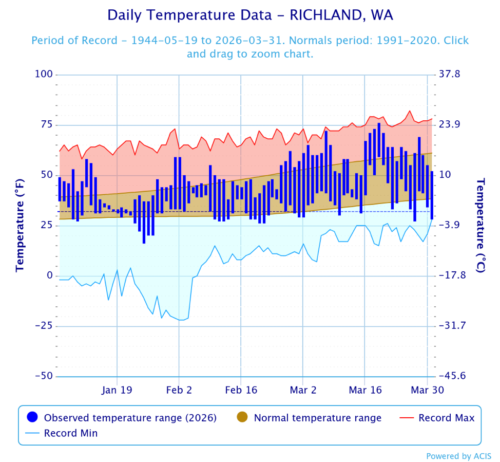
First, let’s look at temperatures from early January to the end of March in the Columbia Valley. The map below is for Richland, Washington. (NOAA is the source.) The dark blue bars in the chart below represent observations, while the brown colors indicate the average temperature range. Record heat is the red line above, and record cold is the blue line below.
Much of this period saw above average temperatures, with several days of near record high temperatures. The overnight lows never came close to record low temperatures.
Oregon
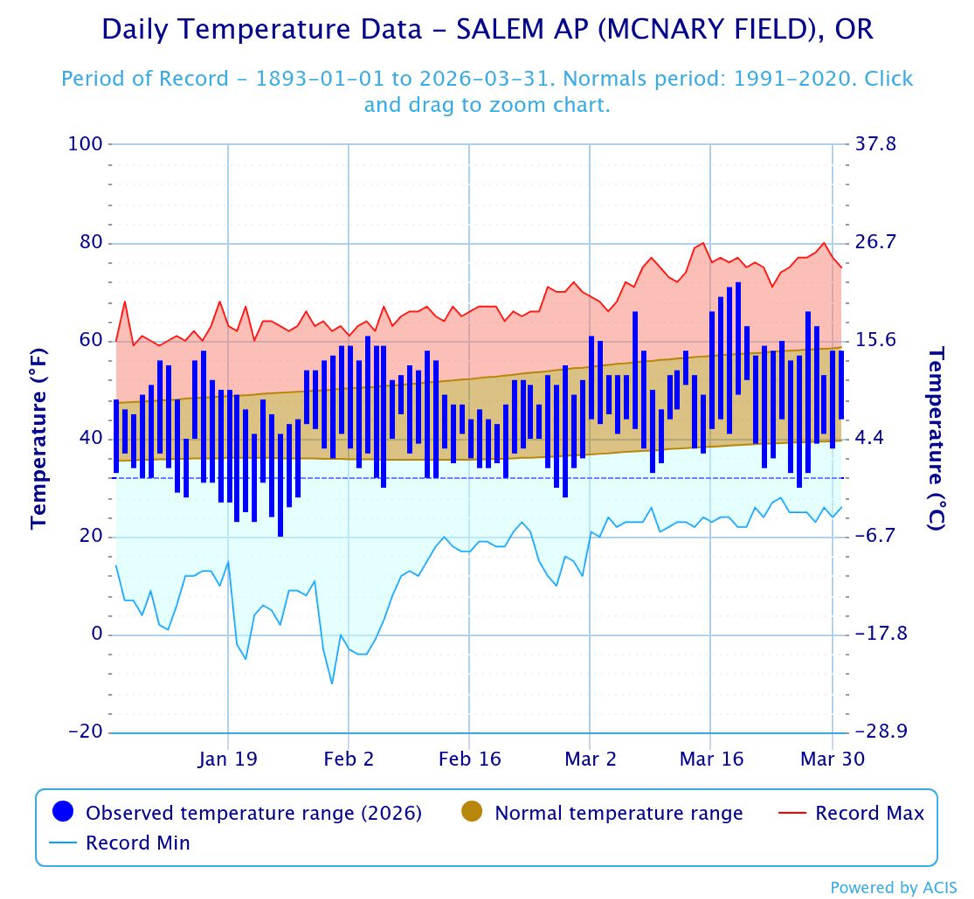
For the Willamette Valley, represented below, we are looking at Salem, Oregon. This area also experienced generally above average temperatures over the period, mingled with average temperatures at times. There were no record high or low temperatures.
Precipitation trends
Washington
Precipitation for Richland since
Please login below to see full content or Subscribe Now to get immediate, full access to our ratings and reviews, review database, featured articles, and other subscriber-only content.


Leave A Comment