

Photo credit Roger Pielke Jr.
The following article was written by Michael Fagin. Fagin is an operational meteorologist providing weather forecasts to clients in the Pacific Northwest and providing custom forecasts for groups climbing Mt. Everest and other major peaks. Fagin is also a travel writer with a focus on weather and wine. Read other articles by Fagin here.
Recent headlines from some credible news sources have been dire. “The world must treat it as the urgent climate warning it is. El Niño conditions will pour fuel on the fire of a warming world.” “El Niño is here. It’ll be big, bad, with heat, floods, droughts, and fires.” “ El Niño is here. Buckle up for a bumpy ride, scientists say. This might become the strongest El Niño on record. Some have even used the name ‘Godzilla El Niño!’
What is El Ninõ and what does it mean for the Pacific Northwest this summer? Let’s delve into it.
El Niño, La Niña, and Neutral
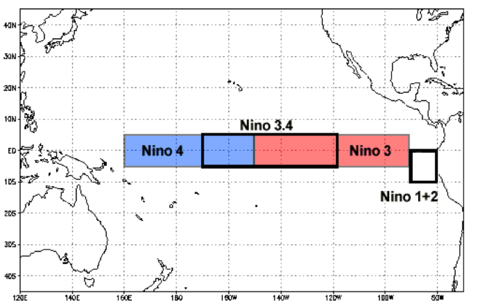
Meteorologists define La Niña or El Niño conditions by evaluating the sea surface temperature anomalies in the equatorial waters off the coast of South America. It is part of the El Niño-Southern Oscillation (ENSO).
Jan Null, CCM provides a technical definition. “The Relative Oceanic Niño Index (RONI) is now the standard that NOAA uses for classifying El Niño (warm) and La Niña (cool) events. It is (partly) the running 3-month mean SST (Sea Surface Temperature) anomaly for the Niño 3.4 region.” (For a deeper dive, you can find data here.)
Temperatures are evaluated in Celsius (C). A 1 degree Celsius change equals 1.8 degree Fahrenheit change. A 0.5 C or higher anomaly is classified as an El Niño. Temperatures at or below the -0.5 C anomaly are classified as a La Niña.
The threshold is further broken down into Weak (0.5 to 0.9 C anomaly), Moderate (1.0 to 1.4 C anomaly), Strong (1.5 to 1.9 C anomaly), and Very Strong (≥ 2.0 C) events.” Neutral conditions are neither La Niña nor El Niño.
Current status and prediction
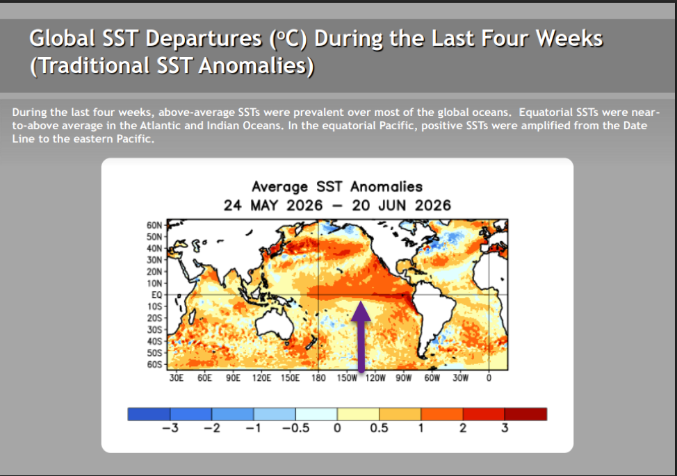
On June 22, NOAA indicated that El Niño conditions are currently present. This is depicted in the map below.
NOAA is also predicting a very strong El Niño for this upcoming winter. How strong?
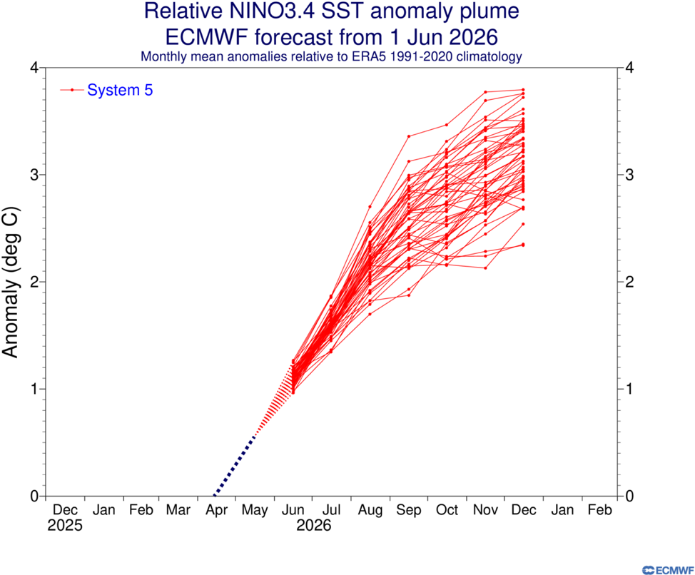
The highly respected European Centre For Medium Weather Forecasts (ECMWF) runs a forecast of 51 different members. By December, there is a forecast ranging from a 2 C to 3.75 C anomaly. (See image below.)
Again, 2 degrees C is considered a very strong El Niño. Many meteorologists think it is possible that this will break the record of the winter of 1997-98 and 2015-16, when it reached an anomaly of 2.4 C. Some are not ruling out a 4 C anomaly. That is a reason for much of the media hype.
What does an extreme historical event tell us?
For the most reliable data on El Niño,
Please login below to see full content or Subscribe Now to get immediate, full access to our ratings and reviews, review database, featured articles, and other subscriber-only content.


Leave A Comment