
The following article was written by Michael Fagin. Fagin is an operational meteorologist providing weather forecasts to clients in the Pacific Northwest and providing custom forecast for groups climbing Mt. Everest and other major peaks. Fagin is also a travel writer with a focus on weather and wine. Read other articles by Fagin here.
In our most recent update, we discussed weather conditions in the Pacific Northwest from mid-October through the end of 2024. Here, we look at recent temperature and precipitation trends in Columbia Valley and Willamette Valley as well as drought conditions. We also look at how La Niña conditions might impact the Pacific Northwest through the end of winter and look into early spring.
Recent temperature trends
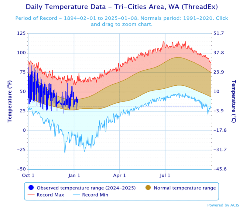
Let’s start by looking at temperatures from October 1st until early January. The map below is for the Tri-Cities Area, WA. (NOAA is the source). Temperatures were generally above average for much of this time.
The blue bars are observations. Brown colors represent the average temperature range. Record heat is the red line above, and record cold is the blue line below. One clear message is there was no record heat or cold during this time.
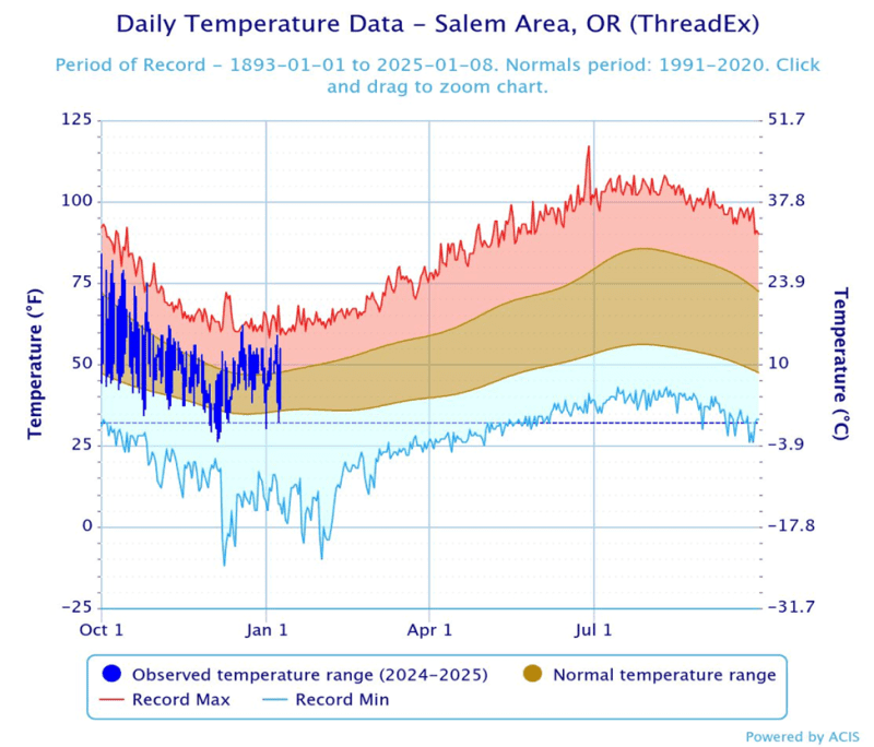
The next map covers the Willamette Valley and Salem area. This region exhibited a mixed bag of conditions. In early October and then towards the later part of December and early January temperatures were above average. Otherwise, temperatures were close to average. There was no record of heat or cold over this period.
Precipitation Trends
Please login below to see full content or Subscribe Now to get immediate, full access to our ratings and reviews, review database, featured articles, and other subscriber-only content.
To receive articles via email, click here.


Leave A Comment