




The following article was written by Michael Fagin. Fagin is an operational meteorologist providing weather forecasts to clients in the Pacific Northwest and providing custom forecasts for groups climbing Mt. Everest and other major peaks. Fagin is also a travel writer with a focus on weather and wine. Read other articles by Fagin here.
The El Niño that has been discussed for months is finally upon us. A lot of ink has already been spilled, calling it “the strongest El Niño on record,” “Super El Niño”, “Godzilla El Niño,” and “the strongest El Niño in a thousand years?” (In terms of the latter, 1950 is widely considered the baseline threshold for reliable, high-confidence instrumental data.)
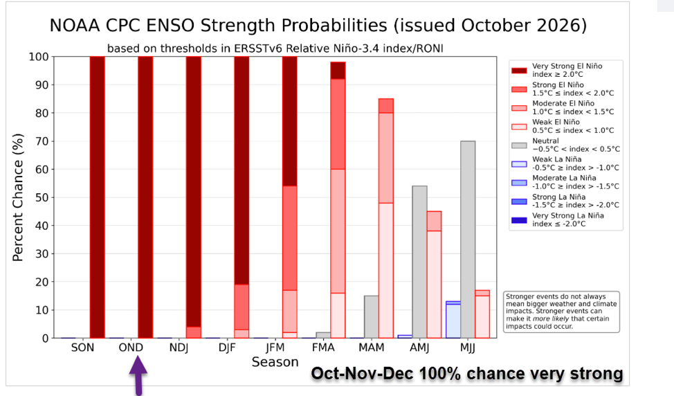
The most recent update from NOAA defines the current status as follows. “El Niño is strengthening, with a greater than 90% chance of a very strong event during the Northern Hemisphere fall and winter 2026-27. The graph below is the percentage chance of how strong the El Niño or La Niña will be. The dark red color represents a very strong El Niño (over 2 C) and for months of OND it is 100%.”
Current status
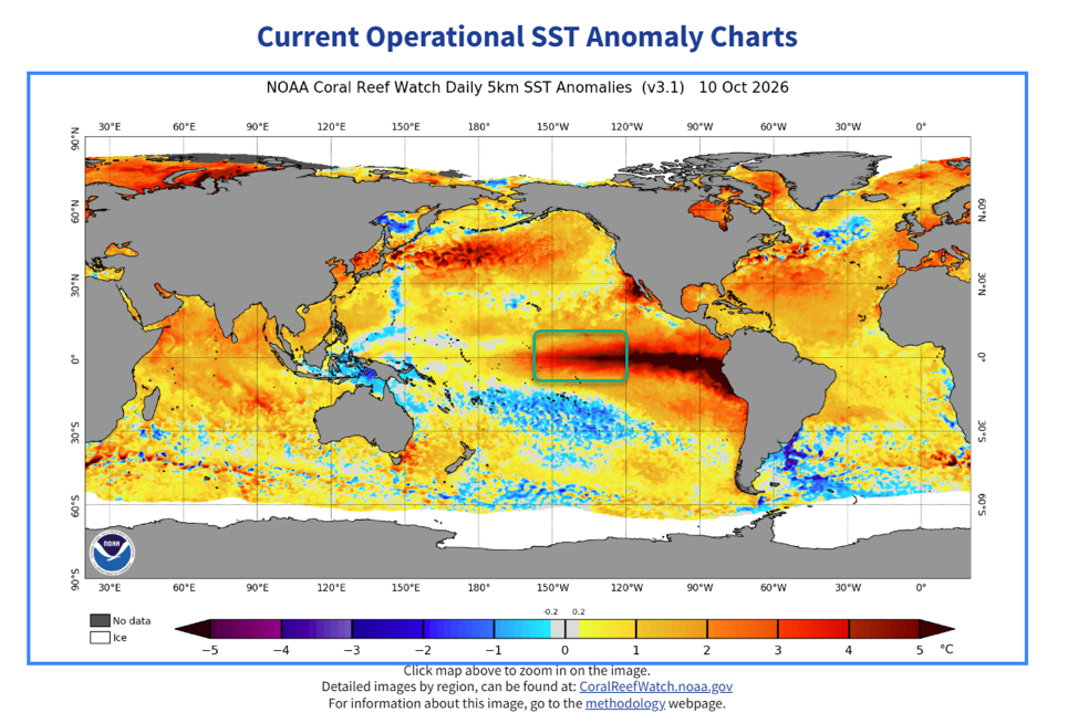
El Niños are measured based on sea surface temperature anomalies in the equatorial Pacific Ocean. The current anomaly is 3.41°C (about 6.1°F) above the average baseline. The El Niño 3.4 region is depicted in the green box below. A weak El Niño is considered to be between 0.50 to 0.90 degrees Celsius above average, moderate 1.0 to 1.4, strong 1.5 to 1.9, and very strong over 2.
The strength of the El Niño will often dictate weather conditions or at least tendencies. At present, we are in a very strong phase. All forecast models predict that the strength will continue to increase. We will discuss what the impact of this might be on weather conditions, with a focus on Washington and Oregon.
El Niño impacts so far
The major weather impacts of El Niño for the Northwest typically occur in the winter. For the other seasons in the Northwest there is not much of a correlation between El Nino conditions and weather tendencies.
However, there is a strong correlation in the summer and fall for the Atlantic and East Pacific during the hurricane season. In a typical El Niño phase, hurricane activity increases in the East Pacific. This season has certainly been very active, with the remnants of Hurricane Rachel recently impacting California with coastal flooding and heavy rain in the southwest. In fact, the remnants of other tropical depressions this summer brought heavy rain to the Southwest at times.
During an El Niño phase, fewer hurricanes form in the Atlantic, and this year has been no exception. The recent formation of Hurricane Isaias marked the latest-forming first-of-the-year Atlantic hurricane on record in 121 years.
Due to these results and others, some sources say this is evidence that the odds are high that whatever El Niño weather patterns normally occur are highly likely to occur this season. However, others say that there is no correlation.
Typical El Niño weather patterns for the Northwest
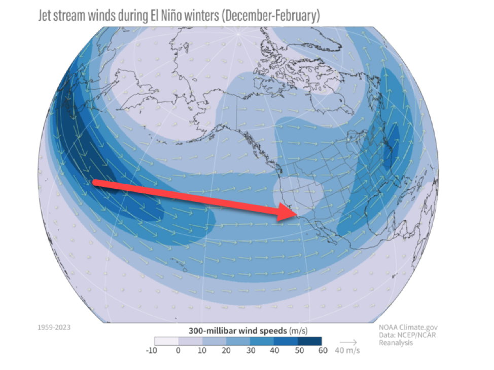
During a typical El Niño, the main part of the jet stream and its associated storm track is aimed at California. This is depicted on the graphic below.
When there is an El Niño in place,
Please login below to see full content or Subscribe Now to get immediate, full access to our ratings and reviews, review database, featured articles, and other subscriber-only content.




Leave A Comment